Tag Archives: walks

Blwyddyn Newydd Dda – Happy New Year

Sunset from the viewing platform, Newborough

Sunset from the viewing platform, Newborough

It’s only a year since the viewing platform at the edge of Newborough beach was built, but its future is already looking a little precarious. The dunes it is built on have eroded back by about four metres, meaning the platform is now teetering on the very edge of them. And with the new moon and high tides of the new year coming together with the persistent storms, who knows what will happen. A good reason to make the most of it now:)

Happy New Year – Blwyddyn Newydd Dda!


Llyn Coron – fly fishing and a circular walk

The coast around Newborough, and most of Anglesey, offers great opportunities for sea fishing. But, if you prefer fly fishing, Llyn Coron provides a beautiful setting for just that. As long ago as 1874, the lake was mentioned in Black’s Picturesque Guide to Wales as being a favourite with anglers .

Llyn Coron lies midway between Aberffraw and Malltraeth, tucked away behind the dunes that flank the A4080.

Llyn Coron lies midway between Aberffraw and Malltraeth, tucked away behind the dunes that flank the A4080.

Llyn Coron is a natural lake formed by the sand dunes at Aberffraw blocking a number of streams from running towards the sea. Llyn Coron collects the water from these small streams and lets it run out to the sea through the Afon Ffraw.

Permits are required for fishing the “hard fighting wild brown trout” and other fish the lake contains:

Llyn Coron Fisheries sign

Llyn Coron Fisheries sign (this is probably out of date by now, so please check their website – www.llyncoronfishery.co.uk)

There is a small pull-in for anglers only on the back lane that runs from Aberffraw towards Bethel.

There is a small pull-in for anglers only on the back lane that runs from Aberffraw towards Bethel.

In theory, there is a path that goes almost all the way around the lake and provides a nice circular walk. Sadly, in practice, the path is often overgrown and sometimes blocked completely by fences… So, if you do decide to walk around the lake, be prepared!

footpath blocked llyn coron

There are two lay-bys off the A4080 just after the hamlet of Llangadwaladr where you can park to access footpaths leading to the lake if you’re not fishing.

A walk to Abermenai Point

Abermenai Point is the most southerly tip of Anglesey. Sitting at the end of Braich Abermenai, a dune and shingle spit, it marks the entrance to the Menai Strait.

A walk to Abermenai Point is almost guaranteed to blow the cobwebs away. And, except for the busiest times in the summer, you can usually enjoy considerable solitude along any of the routes to the point.

If you look at an Ordnance Survey map, you will see that there are “footpaths” shown heading out across the mudflats of Traeth Melynog (Traeth Abermenai on some maps), beyond the dunes of Newborough Warren. Although these paths offer the shortest routes to the point, they are within the tidal zone: you need to be very careful if you use them to make sure that you won’t get trapped by the tide.

Nevertheless, being mindful of the tides, you can make a very nice circular walk starting out from the Llyn Rhos Ddu/Marram Grass car park. From there, follow the path towards the forest for approximately half a kilometre when you will see a lane coming down from your right, and a gate into the dunes on your left.

Footpath into Newborough Warren

Footpath into Newborough Warren

Head into the dunes at this point, and keep following the marker posts all the way across the dunes – it’s very hilly! Finally, you will emerge from the dunes onto the edge of the mud flat and you can see Abermenai point ahead of you.

Post in the Abermenai mudflat looking towards Braich Abermenai

Post in the Abermenai mudflat looking towards Braich Abermenai

There are some concrete posts in the flats which can help to guide you, but they’re not official markers. There is a channel about two thirds of the way across the mud flat – depending on the state of the tide it may be nearly dry or it may be more than knee deep – but you’ll always find a way round it by going inland if you don’t want to get your feet wet.

Tidal channel Traeth Abermenai

Tidal channel Traeth Melynog Abermenai

The mud flats teem with insects, crabs and birds. At certain times of the year they are transformed into a sea of flowers.

Once you’ve crossed the channel, just keep going and you will reach Abermenai Point. There a derelict little ferry house stands alone.

The old house at Abermenai Point

The old house at Abermenai Point

On the opposite side is Fort Belan. Behind that is Caernarfon airport where two large wind turbines have recently been erected.

To complete the circuit head around to the south side of Abermenai Point and then follow the coast all the way along to the forest edge. If the tide is high, you will need to walk along the dune top rather than the shore.

Once you reach the forest edge, turn up (inland) and follow that path, along the forest’s edge, all the way back to the car park.

It’s about a seven mile walk altogether, but it feels longer: it warrants a picnic!

Geomon – Anglesey’s Geopark project – produced a handy pdf guide (670kb) for a similar walk (although following a slightly different, slightly longer route, and in reverse).

A word about tides
The Metoffice website shows tide times as well as the weather forecast on its Llanddwyn/Newborough page (scroll to the bottom of their page for the tide times).

Within the range of “high” and “low” tides there are, of course, very high high tides (so called springs) and very low high tides (so called neaps – from the Anglo Saxon meaning scanty or pinched). Tides at Llanddwyn that are more than 5m are pretty high. A tide that high, especially with the wind behind it, will reduce the beaches to just a slither of sand – or maybe even no beach at all.

Conversely, high tides that are less than 4.5m are low and leave plenty of beach, even when the tide is “high”.

High high tides go hand in hand with low low tides and vice versa. So, on a day when the beach disappears completely at high tide it will be huge at low tide.

Apples and wild cherries – a short walk

Dotted throughout the forest there are various kinds of apple tree and lots of wild cherries (Prunus avium or the gean tree – one of the predecessors of today’s cultivated sweet cherry trees).

Some of the apples have probably grown from pips, others are more like the native wild crab apples, and maybe some are linked back to when there were houses and gardens where the forest now stands.

The wild cherries are very tart, and they’re more stone than flesh, but they’re nice neverthless. They work particularly well in cooked dishes, like apple pie or crumble, adding a beautiful colour and subtle tangy taste.

There is a lovely short walk from the Malltraeth car park at the northern edge of Newborough Forest that leads you through plenty of these fruit trees.

Head out of the car park on the path beside the little corral for horses. The path is quite clear, following along the edge of the forest and the salt marshes that flank the Malltraeth sands.

In the wetter places boardwalks have been installed.

Newborough Forest boardwalk

Keep following the path to the little wooden bridge.

Newborough Forest wooden bridge

Here you can turn left and it will lead you back to the main forest track. Or you can continue on, passing through mixed woodland. The trees are thickly cloaked with lichens and draped with honeysuckle – it smells wonderful in mid-summer. The cherries and apples are dotted throughout, but once they’ve finished flowering, they become inconspicuous.

Newborough Forest willow draped in lichens

This path too will bring you back to the main forest track. At this time of the year (May) long stretches of it are bordered by cherries in blossom.

Newborough cherry blossoms

The short circuit is about 1km, the longer one about 2km – but they can both take quite a long time because there is so much to stop and see along the way!

The grid reference for the Malltraeth forest car park is SH411671.

A tale of two towers: Twr Bach and Twr Mawr

Twr Mawr and Twr Bach Ynys Llanddwyn

Twr Bach (little tower) and Twr Mawr (big tower) are the two towers / lighthouses on the south-east and south-west tips of Ynys Llanddwyn.

Twr Bach has been there a little longer than Twr Mawr, though there seems to be no precise record of when either tower was built.

It’s also quite hard to find the truth about why the towers were built, but it seems Twr Bach was originally built as a landmark and day beacon (an unlit lighthouse). However, it was built in the wrong place – it couldn’t easily be seen by ships approaching from the west. Therefore, Twr Mawr was built to replace it.

Twr Mawr, the former lighthouse, on Ynys Llanddwyn

Twr Mawr, the former lighthouse, on Ynys Llanddwyn

Twr Mawr is on a higher, more westerly promontory and definitely more visible from most directions. As its name suggests it is bigger than Twr Bach, standing nearly 11m tall. The first navigational beacon was put in Twr Mawr in 1845 and it became a working lighthouse on 1st January 1846.

For nearly 130 years Twr Mawr continued as a lighthouse, while Twr Bach lay dormant at its side. But in 1975 when Twr Mawr ceased operation, Twr Bach became the site for the installation of a new, modern navigation beacon. So now, Twr Bach is the working tower, while Twr Mawr is a striking and iconic landmark for Ynys Llanddwyn.

The main footpaths on Ynys Llanddwyn both lead you to Twr Mawr. It’s about a mile and a half walk from the main car park at the end of the forest toll road. Be careful of the tides: when the tide is high, Llanddwyn is cut off for a while.

The view to Twr Bach (left) and Twr Mawr from Llanddwyn beach

The view to Twr Bach (left) and Twr Mawr from Llanddwyn beach

There is interesting information about the history of the towers at Coflein (The Royal Commission on the Ancient and Historical Monuments of Wales) with fantastic aerial images; and at tpwilliams.co.uk (a miscellany of local historical information).

This isn't a particularly good photo of Twr Bach, but I particularly like it because it has a gannet in it (honestly, it does...)

This isn’t a particularly good photo of Twr Bach, but I like it because it has a gannet in it (honestly, it does…)

A walk to the wishing well – Crochan Llanddwyn

Legend has it that the pool in Newborough Forest known as Crochan Llanddwyn (Llanddwyn’s crock or pot) used to be a wishing well. And more than that, it used to be a fortune telling well, where young lovers would go to learn what the fates had in store for them.

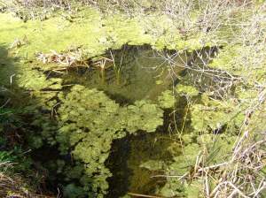
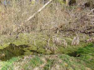
Crochan Llanddwyn: now overgrown by weeds and trees, but popular with newts

Crochan Llanddwyn: now overgrown by weeds and trees, but popular with newts

Crochan Llanddwyn - the old wishing well

Crochan Llanddwyn – the old wishing well

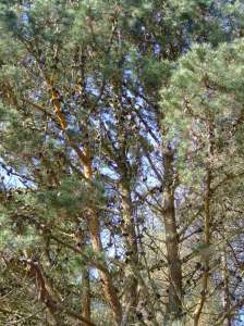
These days, as you can see, it looks a little inauspicious and uninviting. The pool is very neglected and overwhelmed by weeds and algae, and forestry workings have obliterated its original form. Nevertheless, it is still in a lovely place. The pond itself is a good place to see newts. Further along the forest track there are mature Monterey pines (Pinus radiata) which are a favourite place for red squirrels.

Pine trees laden with cones, near Crochan Llanddwyn

Pine trees laden with cones, near Crochan Llanddwyn

You can make a nice circular walk either from Newborough itself, or from the first car park (known as Cwnhingar) along the forest toll road. And maybe it is still worth making a wish as you pass the pool…

The grid reference for the Crochan Llanddwyn is SH40986478 (click here to see the location via gridreferencefinder.com)

The grid reference for Cwnhingar car park is SH4077464097 (here’s the map link). To find the pool, head out of the back of the car park on the main track (through the barrier). Turn right when you meet another track and just keep on that track.  When the main trail sweeps up to the left, keep straight on: you’ll be beside the big old pines then and Crochan Llanddwyn is just a little further on.

Update – April 2014

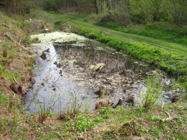
Many of the trees that had grown in and around the pool, and the ones that had fallen over it, have been cleared and now you can see the pool much more clearly. It looks a bit raw at the moment, but later in the year, it will look beautiful again.

Crochan Llanddwyn after its clean-up, April 2014

Crochan Llanddwyn after its clean-up, April 2014

Update February 2023

The pond is looking the saddest I’ve seen it – totally blanketed with weed / algae – seemingly a different sort or sorts than previously. There’s not much hope for the newts there this year. So many of the watery habitats in the forest have been destroyed over recent years:(

Crochan Llanddwyn, Jan 2023

The Giant’s Stepping Stones

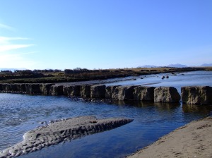
Heading into Newborough from Dwyran, a lane on the left takes you down to The Giant’s
Stepping Stones; more properly known as the Rhuddgaer Stepping Stones.

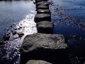
The Rhuddgaer or Giant's Stepping Stones

The Rhuddgaer or Giant’s Stepping Stones

The stones cross the Afon Braint and although they are now part of the Anglesey Coastal
Path, they remain a less visited place. The river is still tidal as it passes the stones,
and if you visit as the tide is turning, you can hear the change.

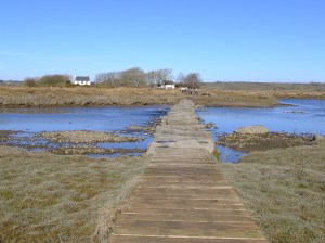
Looking back across the Rhuddgaer Stepping Stones

Looking back across the Rhuddgaer Stepping Stones

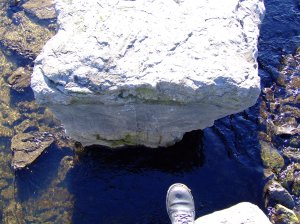
The stones are quite big and some of them are a fair stride apart. If you are able to cross
them, you can carry on along the path to Dwyran. But even if you can’t cross them, it is a
beautiful spot.

The gap between the stones

The gap between the stones

The nearest car park is at the end of Pen Lon (the Marram Grass one). From there, it is
about a mile to the stepping stones. The lane leading down to them is marked with the
Anglesey Coastal Path symbol. If travelling by bus, there is a bus stop right at the end of
the lane.

Rhuddgaer Stepping Stones

Rhuddgaer Stepping Stones

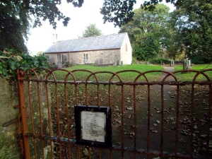
The holiday home of the late Maurice Wilks, an engineer who developed the Land Rover and the first gas turbine car, looks over the stepping stones.  Following his untimely death, Mr Wilks’ was laid to rest at the beautiful and peaceful church of Llanfair yn y Cwmwd in neighbouring Dwyran.

Llanfair yn y Cwmwd

Llanfair yn y Cwmwd

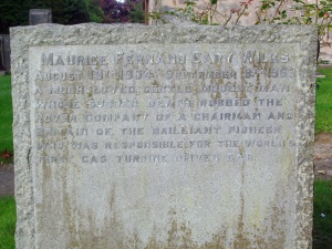
The gravestone of Maurice Wilks - creator of the Land Rover

The gravestone of Maurice Wilks – creator of the Land Rover

The inscription reads:

Maurice Fernand Cary Wilks – August 19th 1904 – September 8th 1963
A much loved, gentle, modest man whose sudden death robbed the Rover Company of a chairman and Britain of the brilliant pioneer who was responsible for the world’s first gas turbine driven car

Some have wondered why there is no mention of the Land Rover in the inscription. Apparently it is because the Land Rover hadn’t become the icon it is today by then and the work which Mr Wilks did for the Rover Company generally and particularly his work on gas turbine engines was of more consequence at the time.

Malltraeth Cob

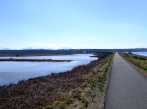
Malltraeth is the next village along from Newborough to the north. The two villages are linked by a “cob” – a dike wall – with a footpath/cycle track along its top.

Malltreath cob - the pools on the left and the sea on the right

Malltreath cob – the pools on the left and the sea on the right and very faintly in the background, the mountains

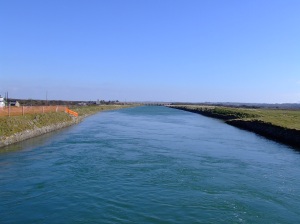
The cob was completed in the early 19th Century, under the direction of Thomas Telford and John Rennie. At the same time, the Afon Cefni was straightened (and straitened) creating what looks like a canal, but is still tidal. This created nearly 1,600ha of grazing land on either side of the Cefni. Much of this land is now a nature reserve managed by the RSPB.

The Afon Cefni at high water

The Afon Cefni at high water

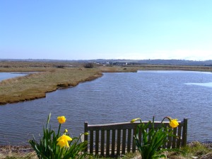
From the cob there are beautiful views in all directions. On the inland side, lie a series of pools, known as the Cob Pools, with the vast Malltraeth Marsh / Cors Ddyga beyond. To the seaward side are the Malltraeth Sands with Malltraeth Bay beyond. The whole area is a haven for wildlife, particularly birds.

One of the benches looking out over the Cob Pools, across the marshes to the mountains beyond

One of the benches looking out over the Cob Pools, across the marshes to the mountains beyond

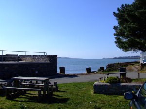
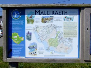
At the Malltraeth end of the cob, there are several benches and a small picnic area (and a chip shop in the village). There are also information boards explaining the history of the cob and the geology of the area, as well as a visual guide to help you identify the mountain peaks that form the horizon to the south.

Malltraeth parking area looking out towards the bay

Malltraeth parking area looking out towards the bay

At the Newborough end of the cob, there is another small car parking area, with picnic benches, known as the Malltraeth car park.

The path on the cob is completely flat. From one end to the other it is about a mile long.

Lots more information about the cob, Malltraeth and the history of the area can be found on the Malltraeth village website: www.malltraeth.com

One of the information boards at Malltraeth

One of the information boards at Malltraeth

Marram grass / morhesg

(nb this is nothing to do with the nearby Marram Grass restaurant the Barrie Bros used to run – that went into voluntary liquidation in 2021. And, somewhat controversially, is set to re-open 2024. )

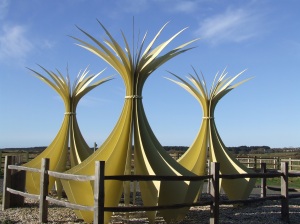
The small car park at Pen Lon features this sculpture representing stooks or sheaves of marram grass (Ammophila arenaria), morhesg (mor = sea, hesg = sedge) in Welsh.

Marram Grass sculpture, Pen Lon, Newborough

Marram grass is particularly important in Newborough’s history: it was a major source of income from mat, basket and rope making; and it protected the village from being buried by the vast dunes.

In 1331, sand from the dunes was blown over the village (or more properly borough) of Newborough, burying fields and houses. In the 16th Century, planting of marram grass was ordered by the government of Elizabeth 1st to try and stabilise the dunes and halt any further advance of them. Uprooting of the grass became a punishable offence.

At this car park, there is a small lake (Llyn Rhos Ddu) with an easily accessible (including for wheelchairs) bird hide. The car park also allows access to the beach by following along the edge of the forest (approx 1.5 miles) – it can be quite a trudge, sometimes wet and muddy in the slacks, but it is worth it. The path is very clear, but not suitable for wheelchairs, pushchairs, etc.

The car park is accessed from the village by turning right at the roundabout at the bottom of the hill (on the way to Dwyran), or from Dwyran going straight over the roundabout.

See Google map

The wreck of the brig Athena

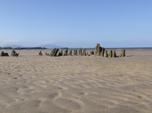
This is what remains of the brig Athena. The ship ran into trouble during a winter storm in December 1852. It was sailing from Alexandria to Liverpool; it seems particularly tough to have come so far and then meet with disaster.

Wreck of the brig Athena on Penrhos Beach, Newborough

Wreck of the brig Athena, with Llanddwyn in the middle distance and the Llyn Peninsula in the hazy background.

However, it isn’t a totally sad story because thanks to the courage of the local lifeboat men, the 14 crew of the Athena were rescued and taken to safety on Llanddwyn.

Now the Athena makes a beautiful and much photographed landmark on the long, and often deserted, Penrhos Beach (Traeth Penrhos) – the beach to the north side of Llanddwyn Island.

You can walk to the wreck either from the Malltraeth car park, or the main Newborough Forest car park. Its approximate grid reference is SH385645 and it’s about a mile and a half or two miles from either car park, or from the village.

Click here to see the approximate location of the wreck in Googlemaps.